The geo industry has shaped the world and the way people go about their lives. This has been clear to people in the industry even before Google saw the potential of using location in their advertising and unleashing Maps into the world. Geo-spatial data forms the backbone of the digital economy. Spatial Data Infrastructures (SDI) is fundamental for shaping decision making processes, for government, business and society.
A call to mission.
How do I propose that the Geo-industry can change the world? Again. We are very aware of worldwide changes to the way people use information. However, the experience of those in the Global North Is very much different to users of location services in the Global South. This can be seen from finding places, navigation and the availability of up to date maps for the basic running of government and commerce. The Geo-industry did not create the disparity between the North and the South, if anything their efforts have created opportunities in the South that were previously unimaginable. Having said that, we have the capability and the capacity to improve the situation in the south.
The Global South is beset with problem that the Geo-Industry can help alleviate. These problems are developmental, political, and societal, and are exacerbated by a lack of information that would at least help shape and develop the debate for change. David Pilling’s (FT Africa Editor) opinion article in the Financial Times articulated the reasons African countries are missing the data needed to drive development citing several African Leaders decrying this state. The UNGGIM 2030 Sustainable Development Goal looked un-achievable in December 2019; however, if we now take into consideration past approach and ‘Business as Usual’, it looks like this goal is in fact a fantasy. We are now aware that we cannot continue this trend and some change is essential to alter the trajectory of humanity.
Yes we can!
So what help the Geo-Industry can provide the South in aid of sustainable development? The importance of a well-developed Spatial Data Infrastructure is acknowledged as a backbone of information organisation and as an essential digital infrastructure. As we know the more advanced a country is the more complex their SDI is. This usually manifest in existence of various agencies providing multiple components. Coupled with sophisticated governance arrangements. Admittedly these complex SDI’s allow many of us to make our living by navigating, decoding and trying to make compatible with each other, within one country or across borders.
Although we have a plethora of information that we can collect from space, and access to data is cheap, the South still lacks the basics of mapping that we all are so accustomed to. Facebook has shown that we can create the necessary data for a continent, Africa, at scale. Microsoft released 18M building footprints in Uganda and Tanzania to enable AI Assisted Mapping. Google have also done work, enriching their maps with outlines of buildings. However, this was done using machine learning which means results vary between places and creates inconsistencies. Yet these examples of available data are not in a state that allows the south to have a workable SDI in the modern sense.
What is the Minimum Viable Product (MVP)?
So what is an MVP that would allow developing countries to be able to organise data on a national level in a meaningful way? This question has been answered by work done by the UN. Various UN bodies have adopted the concept of Land Administration for geospatial data as a bedrock. It is well ingrained in the various international bodies and agencies from the World Bank to Europe wide agencies. To understand how much Land Administration is referenced, searching in Google on land administration produces 757million results, that is 3 times as many as for Tesla results and about 43% of Chocolate results! (OK every time I do the search slight differences occur, but ratios consistent) Imagine something like Land Administration is half as popular as Chocolate.
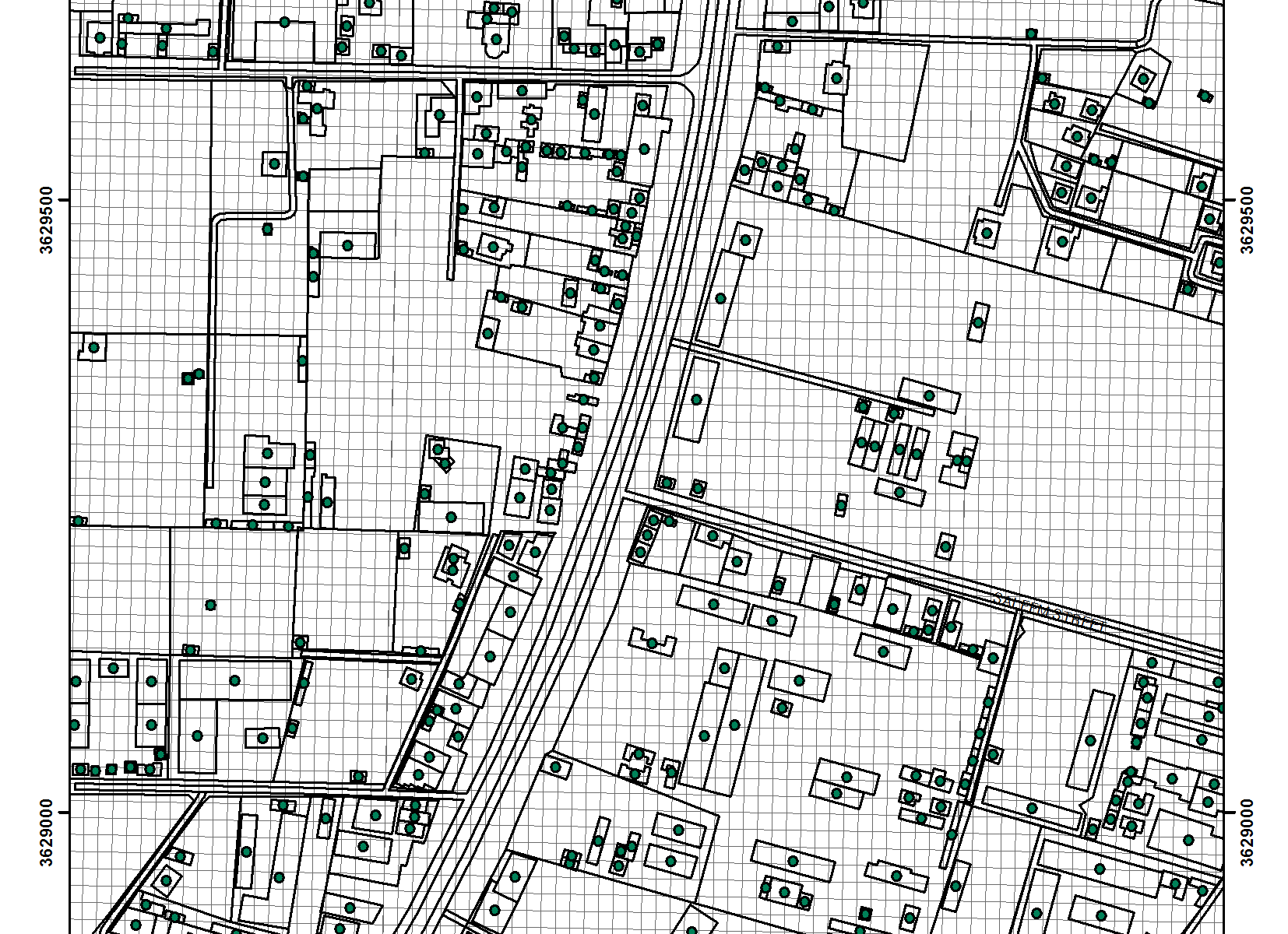
The long struggle in creating Land Administration solution have led to the creation of A Fit for Purpose methodology for developing nations by UNDP, the World Bank and Netherland Kadaster. A basic outline of this approach is the use high resolution satellite images, aerial photography or drones to digitise buildings and land parcels following a set protocol that aims at continuous improvement in the quality of the data.
To this end the World Bank have supported several countries by arranging credit and supporting national initiatives to implement Land Administration. Obviously, the geospatial element is only a part of such an approach, legal administrative educational and capacity building are other notable components. However, mapping is a central component as without it there is no Land Administration as envisaged by the UN and others. But first let us review a case of Land Administration application and see how things developed …..
Ghana A tale of Woe!
The World Bank provided $50m Dollars of investment, $5m Local and $50m from 2011 to 2016 for phase 2 of the Land Administration programme. Phase 1 started in 2003. An additional $35m in 2018 has been allocated for stage 3 of this initiative . Yet after spending all these millions and all this time only 10% of Ghana has been reported as mapped in the last decade. There is no evidence of this mapping outside of articles in the news. Even the website of the Land Administration agency in Ghana that took over 6 years to report the 10% mapping and get a face lift in preparation of another injection from the World Bank, and after spending $55M, and now with another $35m, is not working now. (Accessed on 25th of May 2020 23:40 and 14 June 2020 15:18.)

Why am I picking on Ghana! Other than some familial ties to the country and having a contact who asked me to develop an addressing proposal to take to the President. As with many of these things the proposal fizzled out but now I am paying attention to the country and following developments, there.
What went Wrong in Ghana?
After nearly 10 years Ghana has only managed to map 10% of the land and failed at providing addressing for the mapped area. This failure is multifaceted: political, governance, managerial and technical. The glaring technical shortcomings which may provide some explanation for this breakdown in delivery are:
- Failure to invest in the right technology.
- Failure to focus on functionality and utility so that benefits can be immediately realised within the first year of operations.
- Failure to adopt an addressing system that is effective and simple to use.
The last point above, the failure of adopting an addressing system, is unfortunately a universal failure rather than specific to Ghana.
The problem with Addresses
Ghana has been trying to develop an Addressing system for couple of decades now with little success. Ireland the last OECD country to introduce postal codes, at a cost of €27 million, in 2014 still does not have house numbers in many villages and rural locations despite having road names. Ireland is around a quarter of the size of the surface area of Ghana, and a fifth of the population size, yet has still have not managed to create street numbers across Ireland 5 years later. Notably, the €27 million did not create mapping or full addressing, just postcodes and the campaign to let the population know their postcodes. These two examples expose the weakness of adopting a traditional approach to address creation. Therefore, we cannot really blame developing countries for the failure to advance this point.
Is there a point to mapping without an addressing system!
A lack of an addressing system cannot be used as an excuse for a lack of change. What3three words came up with a solution that was exciting and fun for a while and we have to give kudos for their brilliant promotion to the public, some governments and even in TV programmes. However, what3words is not very practical and is problematic across languages and for automation, especially mail sorting machines. What is needed is a system that immediately allows users to make use of addressing, that provides the same functionalities of a traditional system, in providing unique addresses to buildings and land Parcels, allows Navigation, geocoding so way finding is immediate and is available Universally to all users at a very affordable, or negligible cost.
Say hello to https://plus.codes AKA Open Location Code (OLC). This may be one of the greatest of Google’s creations and is open to all to use, developed in Goggle’s Zurich Engineering office and released October 2014. Yet six years later I am sure Geo-technology people reading this will be surprised to know that it exists. The most important aspect of OLC is its ability to function as a postcode and as a location in very limited number of letters and numbers across the world e.g. 7VJ7+QH, Singapore. To see an example of the great capabilities of this technology see the plus code website and Addressing the Unaddressed.
So now we have an MVP.
Now the MVP is a combination of Land Administration Buildings, Land Parcels mapped to Fit for Purpose level, and Open Location Code. I think this should have been called Open Location Addressing, attached to the buildings and Land Parcels. This is not going to be the ultimate solution, it will have problems and those need solving, the good news is, they are solvable. Creating the MVP will allow all kinds of things to happen, from voter registration, even in slum cities, to better education and health management. It will allow governments to attach population statistics to locations accurately and allow better targeting of investment and support to communities from both the private and public sectors.
So how can we create this MVP?
I spoke earlier about the ability of Facebook, Microsoft and Google to create various products using their AI platforms. This is one way of doing it. How good are the AIs in creating the MVP? My suspicion is that we are still early in getting high accuracy rates, above 90% and we need that kind of accuracy for this to be accepted as a viable solution. This may be a couple or more years down the line. There will be a need to have human intervention on a massive scale. The Open Street Map have shown that this can be done. However, what would be unprecedented is having the big Geo-players team up with grass roots movements like OSM; for the betterment of humanity, we are in territory that needs this kind of intervention. The UNGGIM Future Trends report on International Federation of Surveyors (FIG) need for crowdsourcing and volunteered Geo-information for developing nations. I am sure good will is available on all sides to allow us to do this.
Who Needs to do What?
The first thing that is needed is for Online Mapping giants, like Bing Maps, Here, Apple and the others like Open Street Maps and Mapbox to start using OLC as a searchable and findable asset. Using OLC by the whole industry will put this solution at the centre of addressing, the easiest decision to make, if we put rivalry aside. It is a negligible cost to mapping services but it provides a huge boost for addressing. If you want an incentive for using OLC here is one, the reduction of people being lost while using your navigation system with OLC will provide you with immediate carbon reduction benefits. This will be an effective measure for both the North and the South. Failures in deliveries to rural addresses is rife in the North. The second part of the solution is the difficult part, who is going to do what in the Land Administration mapping domain? It can be done in one of the following two ways:
- A true collaborative open solution: where the geo-industry comes together and split the work. This would improve their AIs with the help of the wider community. The Big Players, or even one can decide to do this, engage OSM and others within a country to help improve the AI outputs or even start providing the input data. Outputs use, benefits, costs for use and added products and service etc. can be sorted out as part of the collaborative approach through a foundation or by adapting an OSM approach.
- A commercial venture: In this approach a venture fund or a big Mapping company can decide to create this MVP and use its knowhow to create a compelling product that they can sell to governments and agencies within the developing world. I have done the maths, investigated the monetisation of mapping and addressing in developing countries. Even without access to the World Bank for funding to create this ready-made solution a venture can make money from this solution.
It is not important which solution finds its way to create this seismic and quantum shift in mapping for the developing countries. As long as we can do it and create a better world.
If we build it will they come?
This is always a question that we must contemplate. I am convinced that this combination of the best addressing solution around with the Land Administration fit for purpose approach. Each of these solutions are validated separately as a solution combining the two creates a compelling offer. The adoption of this solution to underpin the spatial data infrastructures in developing countries will still require a campaign and developing protocols to help adoption and benefits extraction. Cape Verde is now adopting OLC as an addressing system and the adoption of OLC in Calcutta as in Addressing the Unaddressed mentioned above, are encouraging signs of wider adoption.
The provision of a unique identifier for buildings in developing countries has profound, organisational, social and commercial consequences. The ability to attach information reliably and consistently to a single location creates numerous opportunities for, organising, planning and creating efficiency yields.
Last thoughts.
Even with this long article I am afraid I had to be superficial with details and problems that require solving for this solution to happen. However, it is necessary to articulate a first version of this proposal so that it finds roots and can be nourished to bear fruits.
If you have lasted and read this whole article I salute you. Please help make this happen through sharing with others and through providing critical positive feedback and sharing with me and the community ways we can make bring sustainable development to the South through the creation of Minimum Viable SDIs for the good of all of humanity.


